First half of Round Island Route opens, offering 75km-long green corridor for cyclists and pedestrians
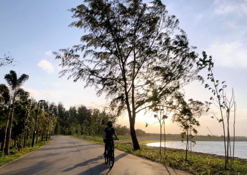
The Round Island Route will be the longest recreational connection looping around the island.
PHOTO: Facebook/nparksbuzz
SINGAPORE - Cyclists and pedestrians can now enjoy a seamless ride or ramble from the north-east to the south of Singapore following the opening of the first half of the Round Island Route.
The 75km-long green corridor winds along the rivers and coast of the eastern half of Singapore and along the Singapore River, ending at Berlayer Creek near the Labrador Nature Reserve.
When the remaining half is completed by 2035, the Round Island Route will be the longest recreational connection looping around the island.
Lookout points and boardwalks offering sweeping sea views were some features unveiled at the opening of the route by the National Parks Board (NParks) on Saturday (Jan 22).
To commemorate its opening, Deputy Prime Minister and Coordinating Minister for Economic Policies Heng Swee Keat, together with Second Minister for Finance and National Development Indranee Rajah and Second Minister for Foreign Affairs and Education Maliki Osman, who is also an MP for East Coast GRC, planted two native coastal plants at Changi Bay Point — a new node along the route.
The idea of a round-island route that people walk, cycle or jog closer to Singapore's coastline was first mooted by the Urban Redevelopment Authority in 2008.
Four years later, then Deputy Prime Minister Teo Chee Hean announced plans for a continuous 150km path to link heritage areas in the city to coastal spots in the east and rustic greenery in the north and west.
[[nid:524226]]
NParks' group director of parks development Kartini Omar said at a media preview on Friday that while the first half of the route was slated to be ready by 2021, several factors including weather conditions and the Covid-19 pandemic delayed its completion until this month.
The recreational connection starts at Rower's Bay Park in Seletar and passes through Sengkang Riverside Park to Changi Bay Point and East Coast Park. It then follows the Singapore River and winds southwards to Berlayer Creek.
On Saturday, more nodes along the route, with amenities such as solar-powered charging points at Changi Bay, Sengkang Riverside Park and Jalan Kayu, were also unveiled.
Cyclists near these nodes can now enjoy better connectivity, with the addition of two bridges at Changi Bay Point and a 290m bridge — the longest in Singapore across a canal — connecting both banks of Sengkang Riverside Park.
Animals also get new housing along the route with the installation of otter holts for the furry creatures to use as breeding places, and marine tiles that act as artificial homes for sea creatures.
The Round Island Route is part of efforts to transform Singapore into a City in Nature under the Singapore Green Plan 2030, said Mr Heng on Saturday.
"As part of these efforts, we are adding more nature parks, intensifying greenery and nature in our parks and gardens, and restoring nature into our urban areas," he said.
"By 2030, every household will be within a 10-minute walk from a park."
Mr Heng added that the completed route will be "three times the length of Singapore" and will connect green spaces on the circumference of the island.
Following Saturday's launch, NParks will continue to strengthen the connectivity and landscaping of the first half of the Round Island Route, as well as widen paths where possible, said Ms Kartini.
When exactly the construction for the western half of the route will begin is still in the works, Ms Kartini noted, but users can expect more rustic sights with the future path venturing near Kranji and Sungei Buloh.
Last year, more than $315 million was committed to developing a network of eight recreational trails spanning 360km, including the Round Island Route.
Asked if NParks was concerned that crowds could overwhelm scenic segments of the new route, Ms Kartini encouraged members of the public to maintain safe distancing and said the board might cordon off lookout points that get too congested.
She added: "And maybe (visitors should) not be too hasty to come to these places because you can take your time to enjoy and appreciate these new spaces that we have opened up for the public."
[embed]https://www.facebook.com/nparksbuzz/posts/307226201445044[/embed]
This article was first published in The Straits Times. Permission required for reproduction.